


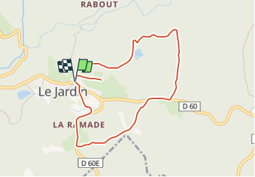

6.9 km | 8.7 km-effort


Tous les sentiers balisés d’Europe GUIDE+


FREE GPS app for hiking
 SityTrail
IGN / Geographical institutes
SityTrail World
The world is yours!
Trail On foot of 4.4 km to be discovered at New Aquitaine, Corrèze, Le Jardin. This trail is proposed by SityTrail - itinéraires balisés pédestres.
Website: https://rando-millevaches.fr/pedestre/le-jardin-bourg/

Walking
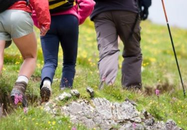
Walking

On foot

Walking

Equestrian

Mountain bike

Walking

Mountain bike
Equestrian